Choose Which Site You Want To See


Ordnance Survey Explorer Ol 61 Active D Grantown-on-spey & Hills Of Cromdale Map - Orange, Orange: Detailed and easy to read map from Ordnance Survey Scale: 1:25, 000 Covers the northern part of the Cairngorms National...

Ordnance Survey Explorer Ol 61 Active D Grantown-on-spey & Hills Of Cromdale Map - Orange, Orange: Detailed and easy to read map from Ordnance Survey Scale: 1:25, 000 Covers the northern part of the Cairngorms National...

Ordnance Survey Explorer Ol 61 Active D Grantown-on-spey & Hills Of Cromdale Map, Orange: Map sheet number OL 61 in the detailed OS Explorer Map series covers the northern part of the Cairngorms National Park...
Ordnance Survey Explorer Ol 61 Active D Grantown-on-spey & Hills Of Cromdale Map, Orange: Map sheet number OL 61 in the detailed OS Explorer Map series covers the northern part of the Cairngorms National Park...

Explorer Ol 61 Active D Grantown-on-spey & Hills Of Cromdale Map: Map sheet number OL 61 in the detailed OS Explorer Map series covers the northern part of the Cairngorms National Park...
Ordnance Survey Explorer Ol 50 Active D Ben Alder, Loch Ericht & Loch Laggan Map, Orange: Map sheet number OL 50 in the detailed OS Explorer Map series is the ideal companion for those looking to discover Loch...

Ordnance Survey Explorer Ol 50 Active D Ben Alder, Loch Ericht & Loch Laggan Map, Orange: Map sheet number OL 50 in the detailed OS Explorer Map series is the ideal companion for those looking to discover Loch...

Ordnance Survey Explorer Ol61 Grantown-on-spey & Hills Of Cromdale Map With Digital Version - Orange, Orange: Providing complete GB coverage, the OS Explorer map series details information essential in the great outdoors,...

Ordnance Survey Explorer Ol61 Grantown-on-spey & Hills Of Cromdale Map With Digital Version - Orange, Orange: Providing complete GB coverage, the OS Explorer map series details information essential in the great outdoors,...
Explorer Ol 61 Grantown-on-spey & Hills Of Cromdale Map: The essential map for outdoor activities in Grantown-on-Spey and Hills of Cromdale. The OS Explorer Map is the Ordnance...

Ordnance Survey Explorer Active Ol60 Lochindorb, Grantown-on-spey & Carrbridge Map With Digital Version - Orange, Orange: The essential map for outdoor activities in all weathers Lochindorb, Grantown-on-Spey & Carrbridge. The OS Explorer...
Ordnance Survey Explorer Active Ol60 Lochindorb, Grantown-on-spey & Carrbridge Map With Digital Version - Orange, Orange: The essential map for outdoor activities in all weathers Lochindorb, Grantown-on-Spey & Carrbridge. The OS Explorer...

Ordnance Survey Explorer Active 141 Cheddar Gorge & Mendip Hills West Map With Digital Version - Orange, Orange: The essential map for outdoor activities in all weathers in Cheddar Gorge andMendip Hills West. The OS Explorer Active...
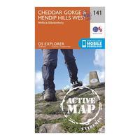
Ordnance Survey Explorer Active 141 Cheddar Gorge & Mendip Hills West Map With Digital Version - Orange, Orange: The essential map for outdoor activities in all weathers in Cheddar Gorge andMendip Hills West. The OS Explorer Active...
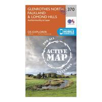
Ordnance Survey Explorer Active 370 Glenrothes North, Falkland & Lomond Hills Map With Digital Version - Orange, Orange: Providing complete GB coverage, the OS Explorer map series details information essential in the great outdoors,...

Ordnance Survey Explorer Active 142 Shepton Mallet & Mendip Hills East Map With Digital Version - Orange, Orange: Providing complete GB coverage, the OS Explorer map series details information essential in the great outdoors,...

Ordnance Survey Explorer Active 370 Glenrothes North, Falkland & Lomond Hills Map With Digital Version - Orange, Orange: Providing complete GB coverage, the OS Explorer map series details information essential in the great outdoors,...
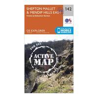
Ordnance Survey Explorer Active 142 Shepton Mallet & Mendip Hills East Map With Digital Version - Orange, Orange: Providing complete GB coverage, the OS Explorer map series details information essential in the great outdoors,...
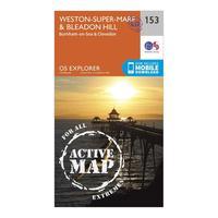
Ordnance Survey Explorer Active 153 Weston-super-mare & Bleadon Hill Map With Digital Version - Orange, Orange: The essential map for outdoor activities in all weathers in Weston-Super-Mare andBleadon Hill. The OS Explorer Active...
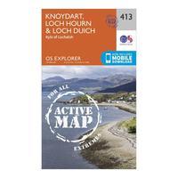
Ordnance Survey Explorer Active 413 Knoydart, Loch Hourn & Loch Duich Map With Digital Version - Orange, Orange: The essential map for outdoor activities in all weathers inKnoydart, Loch Hourn and Loch Duich. The OS Explorer Active...
